
"Pretty" isn't what snowmobilers or cross-country skiiers were hoping for, but if it warms up a little more the snow that we have could be just perfect for building snow men, snow forts, castles, and sliding mogles!
We'll check the village, later on, to see if any such construction is in progress!
And everyone else may get what they want tomorrow!
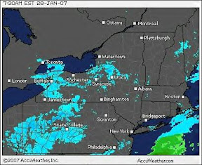
The WeatherChannel ...LAKE EFFECT SNOW WATCH IN EFFECT FROM MONDAY MORNING THROUGH MONDAY EVENING...
THE NATIONAL WEATHER SERVICE IN BINGHAMTON HAS ISSUED A LAKE EFFECT SNOW WATCH...WHICH IS IN EFFECT FROM MONDAY MORNING THROUGH MONDAY EVENING.
A NORTHWEST FLOW OF ARCTIC AIR WILL SET OFF LAKE EFFECT SNOW STARTING TONIGHT. LAKE EFFECT SNOW WILL CONTINUE THROUGH MONDAY AND MONDAY NIGHT...WITH THE HEAVIEST SNOW EXPECTED FROM LATE MONDAY MORNING INTO EARLY EVENING. SNOWFALL TOTALS COULD BE 6 TO 12 INCHES IN THE MOST PERSISTENT SNOW BANDS. THE HEAVIEST SNOWS ARE EXPECTED ACROSS NORTHERN ONONDAGA...NORTHERN MADISON...AND WESTERN ONEIDA COUNTIES.
A LAKE EFFECT SNOW WATCH MEANS THERE IS A POTENTIAL FOR LAKE EFFECT SNOWS TO PRODUCE 7 INCHES OR MORE OF SNOW IN 12 HOURS OR LESS...WHICH COULD SIGNIFICANTLY IMPACT TRAVEL.
And while you're waiting: this small internet amusement has been making the rounds, and you might be surprised to find that your accent gives you away! So far, we know that I live in "northern inland (America)" - as do many of my acquaintances - but that Mr. Brown is most definitely from Boston!